Before buying property in Tamarindo, find out whether the lot touches the 200 metre maritime zone, whether it is titled land or a state concession, and whether it overlaps protected land. Folio measured at least 125 registered parcels touching Tamarindo's maritime strip, and roughly 69% of that strip overlaps protected land. Pull the registry record and the cadastral map before you negotiate anything else.
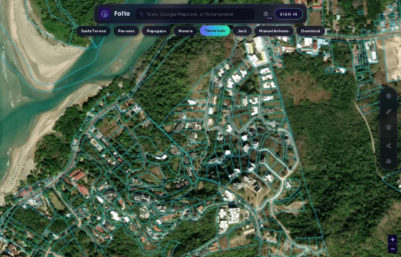
This is Tamarindo in the Folio app.
Every outline is a registered parcel from the national cadastre. Tap any lot and Folio shows you the maritime line, protected areas and water on top of it, in seconds, before you call a lawyer or put down a deposit.
See every parcel in Tamarindo on the map
What the records showTamarindo's maritime strip, measured
From Folio's August 2026 maritime zone dataset; parcel counts are lower bounds and cannot tell titles from concessions.
What should you check first when buying property in Tamarindo?
In Tamarindo, start with the coastline. Most of the questions that matter for a buyer here come down to where a parcel sits relative to the legal maritime strip, what kind of right the seller actually holds, and whether protected land is involved. Price, views and rental potential can wait until those answers are on paper.
Tamarindo is in the canton of Santa Cruz, in Guanacaste province. The coast is heavily registered, which can make listings look more settled than they are. A parcel that appears on the official cadastre map is not automatically private property, and near the beach that distinction decides almost everything.
Our Tamarindo property check page is a starting point. Folio's free property check covers the official cadastre, maritime zone, protected areas and water layers for a parcel. Use the records described below to confirm what you see.
What do Folio's maritime zone numbers say about Tamarindo?
Folio measured the maritime strip along Tamarindo's coast as part of a town-level dataset covering 27 coastal towns. The full town figures are on our Tamarindo maritime zone data page. Here is what we found, measured in August 2026.
| Measure | Tamarindo |
|---|---|
| Area of the 200 m maritime strip | 2.269 km² |
| Registered parcels touching the strip (lower bound) | 125 |
| Registered parcels entirely inside the strip (lower bound) | 40 |
| Share of the strip covered by registered parcels | 92.4% |
| Registered geometry overlapping the first 50 m | 0.5867 km² |
| Strip area overlapping protected land | 1.555 km² |
Two cautions about these numbers. First, parcel counts are lower bounds. We found parcels by sampling the Registro Nacional cadastre on a grid and removing duplicates, so some parcels can be missed but none are invented. Second, the map cannot tell a titled property from a state concession. Both appear as registered parcel geometry.
Why "registered" does not mean "titled" near the beach
The zona marítimo terrestre (maritime terrestrial zone, often shortened to ZMT) is defined in the maritime zone law published by the ICT as "la franja de doscientos metros de ancho a todo lo largo de los litorales Atlántico y Pacífico", a strip 200 metres wide along both coasts, measured from the ordinary high-tide line.
The law splits that strip in two. The first 50 metres are the Zona Pública (public zone). The remaining 150 metres are the Zona Restringida (restricted zone). In the restricted band, most registered parcels are state concessions: a right to use land for a period under conditions, not ownership.
So when you read that 92.4% of Tamarindo's strip is covered by registered parcels, read it as "almost all of it is spoken for", not "almost all of it is private". The seller may hold a title, a concession, or something messier. Only the registry record says which. For background on how concessions work, see our guide to the Costa Rica maritime zone explained for buyers.
One rule matters for foreign buyers. The law states that concessions are not granted "a extranjeros que no hayan residido en el país por lo menos durante cinco años", meaning foreigners who have not lived in Costa Rica for at least five years. If the lot is a concession, ask your attorney how this applies to you and to any company structure being proposed.
What does the protected land overlap mean for a buyer?
Roughly 69% of Tamarindo's maritime strip overlaps protected land, based on SINAC data covering national parks, refuges and Patrimonio Natural del Estado (state natural heritage, often called PNE). That is 1.555 km² of the 2.269 km² strip.
Restrictions on protected land are far stricter than the normal concession rules. A lot that looks like an ordinary beach-area parcel on a listing may sit partly or wholly on land where building, clearing or fencing is limited or not allowed. Even outside protected areas, the law prohibits fencing ("deslindar con cercas"), exploiting flora and fauna, and other development in the zone without legal authorization.
The law also treats all mangroves as public zone, "sea cual fuere su extensión", whatever their extent. If there are mangroves or wetlands near the lot, do not assume the public zone ends neatly at 50 metres from the sea. Ask your surveyor and attorney whether any mangrove or wetland boundary affects the lot.
Check any Tamarindo lot against the maritime line in the free app.
Check it freeWhy do some parcels overlap the first 50 metres?
The first 50 metres are inalienable public zone. Yet Folio measured 0.5867 km² of registered parcel geometry overlapping that band in Tamarindo. That does not by itself mean anything improper is happening. There are three possible explanations, and they look identical on a map:
- Lawful concessions that legitimately reach into the area.
- Pre-1973 exceptions, which only an attorney reviewing the history can assess.
- Mapping offsets, where the drawn parcel and the official coastline do not line up precisely.
Only a registry pull, read by someone who knows what to look for, tells these apart. If a lot you like touches the first 50 metres, treat it as a question to resolve, not a conclusion.
Get the free Costa Rica buyer's checklist
What to ask for, what to pull from the registry and what to confirm on the map before you sign anything. One short email, no spam.
Which records should you pull for a Tamarindo lot?
These are the documents that turn map impressions into facts. Your attorney or notary will know how to request and read them, many through the Registro Nacional digital services.
- The certificación literal (full registry certificate) of the property, showing the registered owner or holder, the nature of the right, and any gravámenes (encumbrances) and anotaciones (pending annotations).
- The plano catastrado (registered cadastral survey map), to compare the parcel's drawn boundaries with what you were shown on site.
- Confirmation of whether the parcel is titled land or a concession, and if a concession, its term, conditions and current standing.
- An overlay of the parcel against the 200 m maritime line, the 50 m public zone and any protected area or mangrove boundary.
- Municipal records from Santa Cruz, including property tax status and, for concessions, the concession file and payment history.
- Whether a coastal regulatory plan applies to that stretch of coast. The ICT maritime zone programme publishes information on coastal plans and regulations.
What questions should you ask about a specific Tamarindo property?
Bring these to the seller, the agent and, above all, your attorney:
- Is this property titled, a concession, or partly each? Which documents prove it?
- How far is the nearest boundary from the ordinary high-tide line, and who measured it?
- Does any part of the parcel overlap protected land, mangroves or an estuary?
- If it is a concession, can I hold it given my residency status, and what conditions apply to transfer?
- Do the cadastral map and the boundaries on the ground match?
- Are there liens, annotations or unpaid taxes or concession fees?
- Were existing buildings authorized, and do they fall within any restricted band?
If you are looking at anything close to the sand, our guide to buying a beachfront lot in Costa Rica covers the traps in more depth.
What can the public data not tell you?
Folio's numbers describe the coastline as a whole. They show how crowded and how protected Tamarindo's strip is, and they flag which questions deserve attention. They do not tell you whether a particular lot is a title or a concession, whether a concession is in good standing, or how a pre-1973 history will be treated.
Those answers sit in the registry and municipal files, and their meaning is a legal judgement. Folio shows what the public records say. An attorney or notary advises on what that means for your purchase.
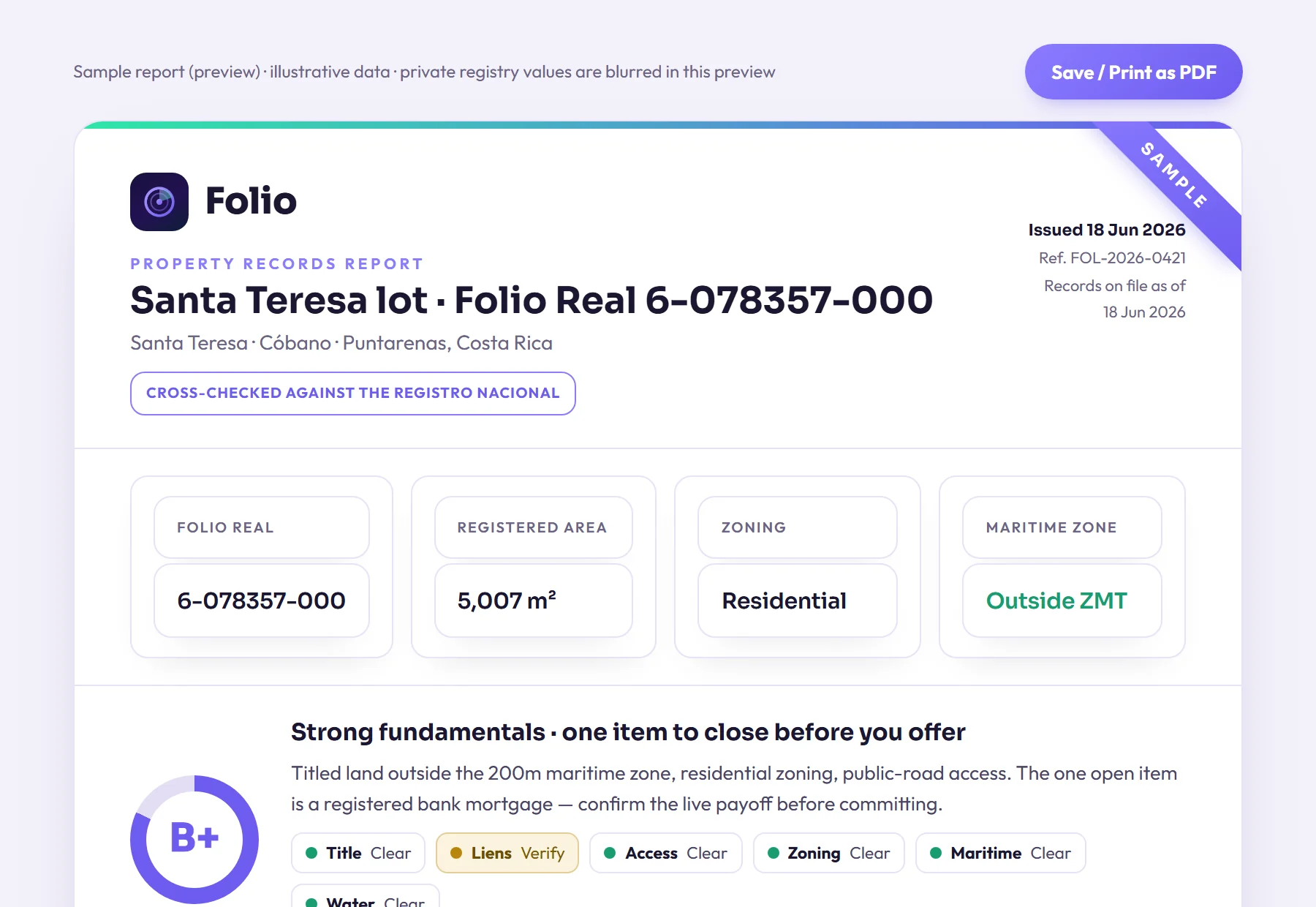
Know what you're buying before the deposit.
Most problems with a lot don't show up in the listing, and often the seller doesn't know about them either. Folio lets you find them now, before you pay a lawyer to start the purchase.
Frequently asked questions
Is property in Tamarindo's maritime zone privately owned?
Not necessarily. The first 50 metres from the ordinary high-tide line are public zone, and in the remaining 150 metres most registered parcels are state concessions rather than titled land. Only the registry record shows which kind of right a specific seller holds.
Can a foreigner hold a beach concession in Tamarindo?
The maritime zone law says concessions are not granted to foreigners who have not resided in Costa Rica for at least five years. How that applies to you, or to a company being proposed for the purchase, is a question for your attorney before you sign anything.
How much of Tamarindo's coast is protected land?
Folio measured 1.555 km² of the 2.269 km² maritime strip overlapping protected land, roughly 69%, using SINAC data. Restrictions on protected land are far stricter than normal concession rules, so check any lot against those boundaries early.
Are Folio's Tamarindo parcel counts complete?
No, they are lower bounds. Folio found parcels by sampling the national cadastre on a grid and removing duplicates, so the true number touching the strip may be higher than 125. The counts also cannot distinguish titled parcels from concessions.
Sources
- Registro Nacional digital services (certificaciones and registry consultations), Registro Nacional de Costa Rica
- Ley sobre la Zona Marítimo Terrestre, Ley 6043 (full text published by ICT), Instituto Costarricense de Turismo (ICT)
- Zona Marítimo Terrestre (maritime zone programme, coastal plans and regulations), Instituto Costarricense de Turismo (ICT)
- Folio data: The State of Costa Rica's Maritime Zone 2026 (Folio study; counts are lower bounds); Folio's town page.
Educational, not legal advice. Folio reports what public records show; it does not replace a licensed Costa Rican attorney, notary or surveyor. Confirm material facts with them before any transaction. Photos are illustrative of the region.